Storm spurs wind and coastal flooding advisories in NYC, leaves thousands without power in NJ
Jan. 10, 2024, 8:08 a.m.
A wind advisory is in effect until 8 p.m. Wednesday for Manhattan and Staten Island, with city officials warning people to beware loose branches and downed trees and wires.
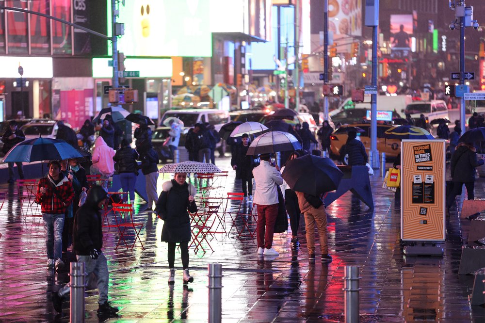
New Yorkers woke up Wednesday morning to wind and coastal flooding advisories spurred by an overnight storm that brought gusts as high as 61 mph in Queens and rainfall totals of around 2 inches in many parts of New York City.
In central and northern New Jersey, tens of thousands were without power, and officials were warning of serious flooding risks for Wednesday and Thursday along several rivers.
The National Weather Service issued a wind advisory for Manhattan and Staten Island until 8 p.m. Wednesday, with sustained winds of 15 to 25 mph and up to 50 mph gusts expected.
City emergency management officials warned the public to avoid loose tree branches and downed trees and urged calling 311 for service requests and 911 for downed wires.
It’s going to be a windy day & evening for Manhattan and Staten Island. Please watch for loose tree branches and limbs, and downed trees, call 311 to submit a service request.
— NYC Emergency Management (@nycemergencymgt) January 10, 2024
Treat all downed wires as live and report them to 911. https://t.co/9qDFrZfa8y
As of around 6:45 a.m., an NYPD spokesperson said the department had received no reports of injuries or damage due to the storm. An FDNY spokesperson said shortly before 8:30 a.m. no storm-related incidents had been reported citywide.
As of 7:15 a.m., more than 2,100 Con Edison customers were reported without power, largely in Westchester and Queens. More than 3,700 PSEG customers were reported without power across Long Island.
A flood warning was in effect for the Bronx and Westchester until 10 a.m., with impacts likely along the Bronx River. Officials urged residents to avoid the area of the river, which was near a major flood stage by 8:40 a.m.
Coastal flood advisories and warnings were in effect throughout the tri-state area, as many rivers and streams continued to rise due to storm runoff. NWS said “widespread moderate coastal flooding” was anticipated across southern Queens and Long Island.
We are now entering the coastal flooding stage--coastal flood warnings and advisories are in effect. Widespread moderate coastal flooding is expected across the south shore of LI and southern Queens. Report your impacts at https://t.co/MhlPDx0eDw when it is safe to do so! pic.twitter.com/38bcXHltyx
— NWS New York NY (@NWSNewYorkNY) January 10, 2024
All MTA bridges and tunnels were operating normally as of 7:30 a.m., according to NYC Emergency Management. No major storm-related subway delays were reported, though there were some cancellations and delays on Amtrak and MetroNorth. Some MTA buses were being detoured in Manhattan and Queens due to flooding. (See MTA service alerts here.)
Amtrak said shortly after 9 a.m. that all trains between NYC and Albany "may experience lengthy delays due to high water along the route."
No major delays were reported at local airports Wednesday morning.
In Brooklyn, nearly 2,000 migrants who had been evacuated Tuesday afternoon from a large-scale tent shelter at Floyd Bennett Field because of the storm forecast were transported back there by 4:30 a.m. Wednesday, city emergency management officials said.
The migrants, comprising almost 500 families, had been taken to James Madison High School for the night, where they were visited by Mayor Eric Adams and other city leaders. The school will operate on a remote basis Wednesday, according to a spokesperson for NYC Emergency Management.
At 0110 Hours the winds at Floyd Bennett Field subsided.
— NYC Emergency Management (@nycemergencymgt) January 10, 2024
As of 0427 Hours our temporary relocation of Floyd Bennett Field HERRC guests to James Madison High School was completed and all guests safely returned to Floyd Bennett Field HERRC. https://t.co/EFhsRRLUGG
New Jersey impacts
By early Wednesday morning, most parts of New Jersey had seen between 2 and 4 inches of rain. No more rainfall was expected, but the National Weather Service was expecting rivers to crest at several points through Central and North Jersey.
By 7:30 a.m., about 37,000 customers of utility companies JCP&L and PSEG remained without power, though there had been more overnight. Nearly 10,000 of JCP&L’s customers were without power in Monmouth County, another 5,700 in Hunterdon County, 3,500 in Sussex County and 3,500 in Ocean County. Most North Jersey PSE&G customers had already seen their power restored.
The Saddle River at Lodi, in Bergen County, had already passed its major flooding stage of 7.7 feet, reaching nearly 10 feet by 7 a.m., though the levels were expected to start decreasing and be below flood stage by late evening.
Crystal Lake in Oakland, also in Bergen County, flooded streets overnight, police there said on Facebook. The borough's fire department was helping residents with evacuations.
The Millstone River in the Griggstown area of Franklin Township, in Somerset County, was at a major flood stage, as was the South Branch Raritan River in the Stanton area of Readington Township, in Hunterdon County, according to NWS.
The Passaic River at Little Falls, in Passaic County, was only at an “action” stage early Wednesday morning, but expected to reach a major flood stage by Thursday, with waters rising until Thursday evening.
Little Falls evacuated hundreds of people from streets near the river during December’s heavy rains, after 12 years with no such flooding, according to Mayor James Belford.
“After the first one, I saw the resiliency,” he said. “Now with the second one in just three weeks, it's clear that that's going to change to frustration and additional concerns.”
Belford urged residents to avoid coming or going from their homes during the peak of the projected floods.
“Either get out in advance of the water rising, or if you're able to stay in your home when it does surround your house, you're typically safer than potentially trying to leave then,” he said.
Matthew Tiedeman, the coordinator of Bergen County's Office of Emergency Management, said he’d been up all night dealing with flooding in low-lying areas — closed off streets, downed power lines and minor damage.
He said he was watching for potential problem areas around Lodi, northern Hackensack, Oradell, New Milford and River Edge, and that swift water crews were ready for any rescues along the Saddle River.
But there hadn’t been major damage as of early Wednesday morning, he said.
“I’m pretty sure the phones are going to start ringing soon because people are just getting up to work, and they’ll realize that their road is flooded or their tree came down, or they have damage,” Tiedeman said.
Check out our maps on the latest rainfall and flooding data across NYC and New Jersey.
See where rain, wind, floodwaters peaked in NYC and NJ from overnight storm NYC evacuating up to 500 migrant families from Floyd Bennett Field shelter as storm intensifies