NY Offshore Wind
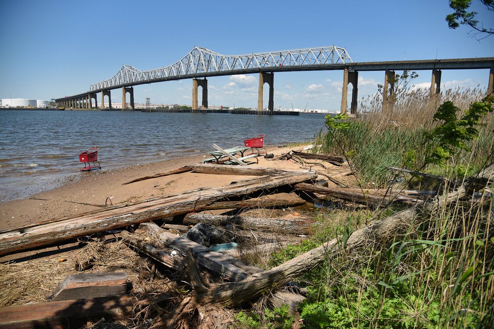
The proposed site of the Arthur Kill Terminal, on the southwest coast of Staten Island
01_Kensinger_Arthur_Kill_DSC_0099.jpg
The proposed site of the Arthur Kill Terminal, on the southwest coast of Staten Island
Nathan Kensinger for Gothamist
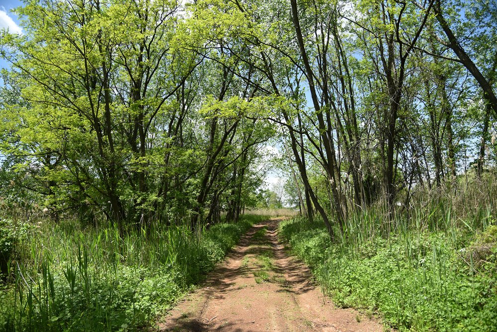
The proposed site of the Arthur Kill Terminal, in Staten Island, is accessed via two dirt roads off of Arthur Kill Road in Richmond Valley.
10_Kensinger_Arthur_Kill_DSC_0177.jpg
The proposed site of the Arthur Kill Terminal, in Staten Island, is accessed via two dirt roads off of Arthur Kill Road in Richmond Valley.
Nathan Kensinger for Gothamist
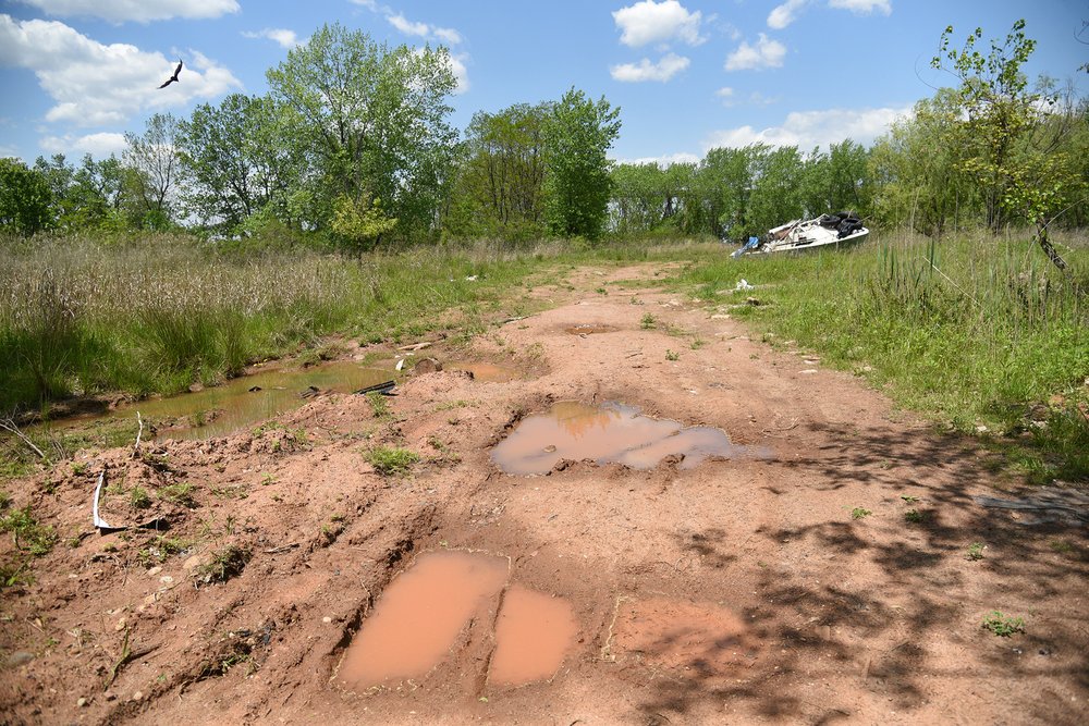
The dirt roads at the proposed site of the Arthur Kill Terminal are frequently flooded and pass through woodlands, meadows and wetlands.
11_Kensinger_Arthur_Kill_DSC_0186.jpg
The dirt roads at the proposed site of the Arthur Kill Terminal are frequently flooded and pass through woodlands, meadows and wetlands.
Nathan Kensinger for Gothamist
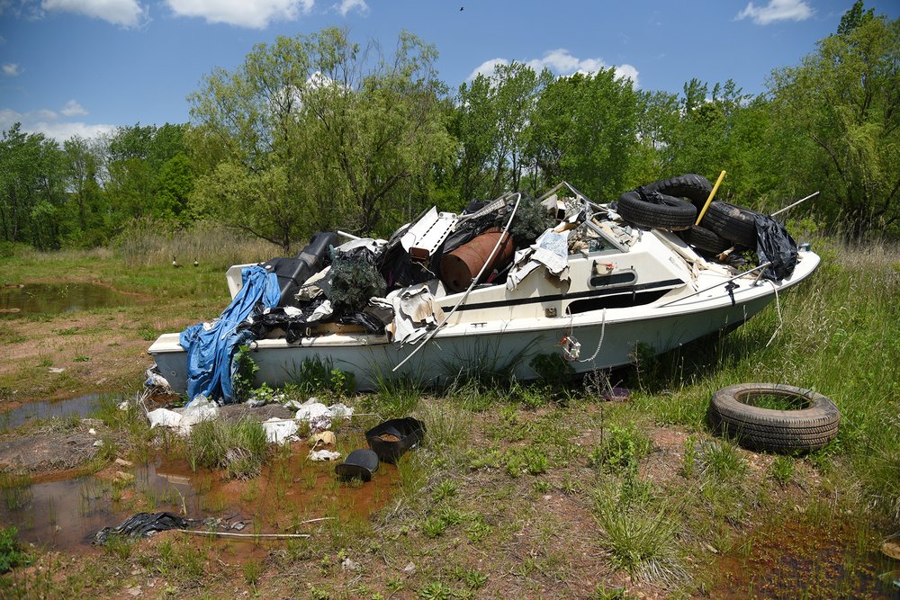
An abandoned boat, filled with debris, is one of the only remnants left by human visitors to the proposed site of the Arthur Kill Terminal.
12_Kensinger_Arthur_Kill_DSC_0199.jpg
An abandoned boat, filled with debris, is one of the only remnants left by human visitors to the proposed site of the Arthur Kill Terminal.
Nathan Kensinger for Gothamist
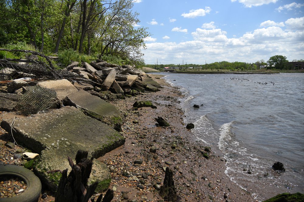
On the site’s southern edge, at the mouth of Mill Creek, the shoreline is covered with broken concrete slabs and wooden pilings, remnants of earlier industrial businesses, which include a lumber yard and coal yard.
14_Kensinger_Arthur_Kill_DSC_0232.jpg
On the site’s southern edge, at the mouth of Mill Creek, the shoreline is covered with broken concrete slabs and wooden pilings, remnants of earlier industrial businesses, which include a lumber yard and coal yard.
Nathan Kensinger for Gothamist
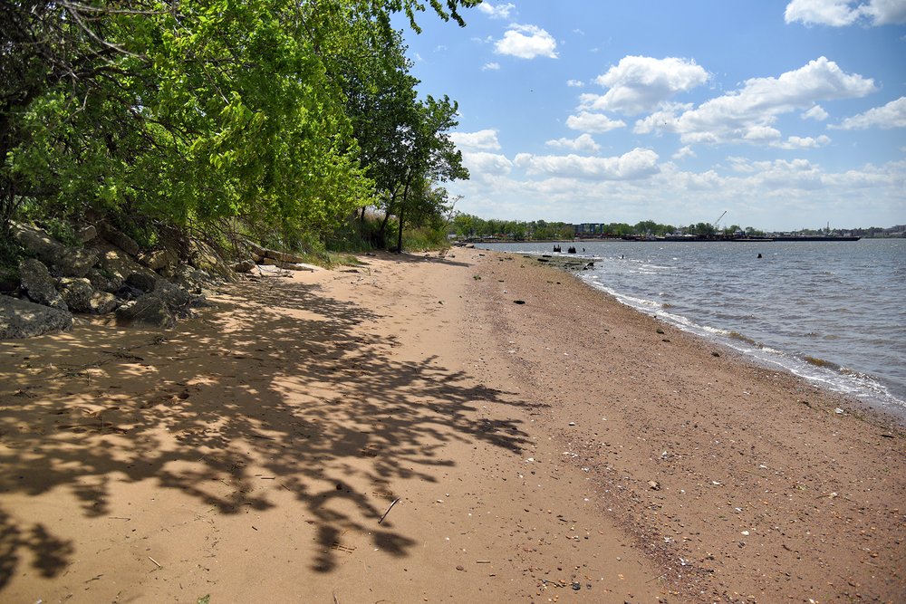
A wide, sandy beach stretches along the site’s Arthur Kill waterfront, at the foot of a 15-foot-high cliff of concrete rubble. The Arthur Kill is a 10-mile-long tidal strait, and its Staten Island shoreline is accessible in just a handful of locations.
15_Kensinger_Arthur_Kill_DSC_0269.jpg
A wide, sandy beach stretches along the site’s Arthur Kill waterfront, at the foot of a 15-foot-high cliff of concrete rubble. The Arthur Kill is a 10-mile-long tidal strait, and its Staten Island shoreline is accessible in just a handful of locations.
Nathan Kensinger for Gothamist
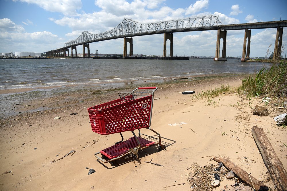
An abandoned shopping cart on the beach. The proposed site of the Arthur Kill Terminals is located immediately adjacent to the Outerbridge Crossing.
17_Kensinger_Arthur_Kill_DSC_0296.jpg
An abandoned shopping cart on the beach. The proposed site of the Arthur Kill Terminals is located immediately adjacent to the Outerbridge Crossing.
Nathan Kensinger for Gothamist
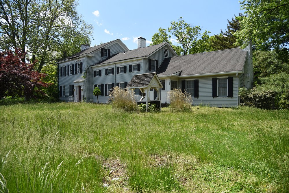
The Cole House, a historic home dating back to the 1840s, is located within the site’s footprint. The developers have committed to preserving this structure as a visitor center, exhibition space, and viewing platform.
18_Kensinger_Arthur_Kill_DSC_0141.jpg
The Cole House, a historic home dating back to the 1840s, is located within the site’s footprint. The developers have committed to preserving this structure as a visitor center, exhibition space, and viewing platform.
Nathan Kensinger for Gothamist
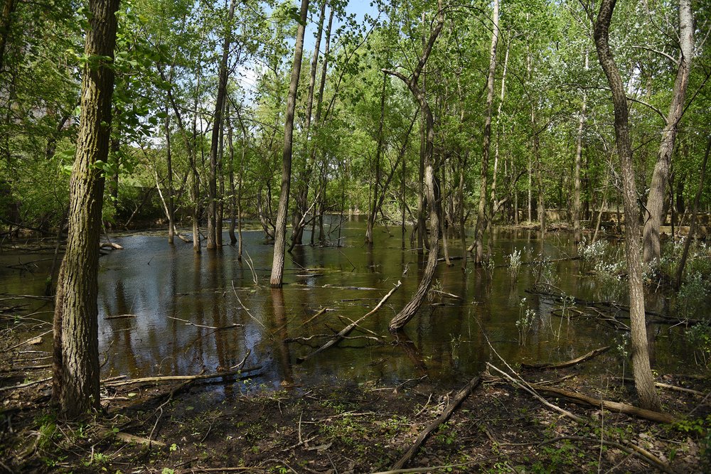
At the NYCEDC’s Rossville Municipal Site, woodlands and wetlands have grown over an abandoned post-industrial landscape. A vernal pond has formed near the base of a neighboring liquefied natural gas tank.
19_Kensinger_Rossville_2022_DSC_0423.jpg
At the NYCEDC’s Rossville Municipal Site, woodlands and wetlands have grown over an abandoned post-industrial landscape. A vernal pond has formed near the base of a neighboring liquefied natural gas tank.
Nathan Kensinger for Gothamist
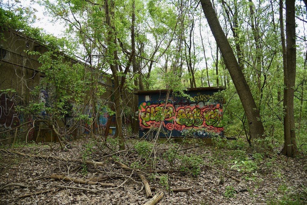
Abandoned warehouses are obscured by trees, vines and poison ivy at the 10-acre inland portion of the Rossville Municipal Site. This site was purchased by the city in 1990, as part of a never-realized plan to build a correctional facility.
20_Kensinger_Rossville_2022_DSC_0363.jpg
Abandoned warehouses are obscured by trees, vines and poison ivy at the 10-acre inland portion of the Rossville Municipal Site. This site was purchased by the city in 1990, as part of a never-realized plan to build a correctional facility.
Nathan Kensinger for Gothamist
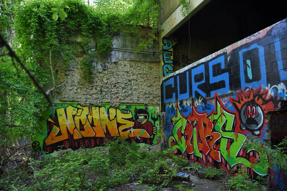
Layers of graffiti cover many of these abandoned warehouse structures. The site has been a popular destination for graffiti artists for more than a decade.
21_Kensinger_Rossville_2022_DSC_9990.jpg
Layers of graffiti cover many of these abandoned warehouse structures. The site has been a popular destination for graffiti artists for more than a decade.
Nathan Kensinger for Gothamist
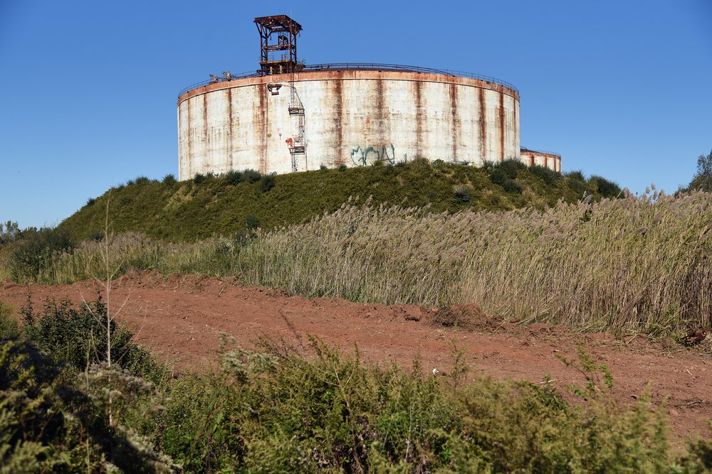
The neighboring liquid natural gas (LNG) facility, along Chemical Lane, is privately owned. The property is currently being remediated, to remove illegally dumped materials, which has interrupted plans to demolish the LNG tanks.
23_Kensinger_Rossville_2021_DSC_6218.jpg
The neighboring liquid natural gas (LNG) facility, along Chemical Lane, is privately owned. The property is currently being remediated, to remove illegally dumped materials, which has interrupted plans to demolish the LNG tanks.
Nathan Kensinger for Gothamist
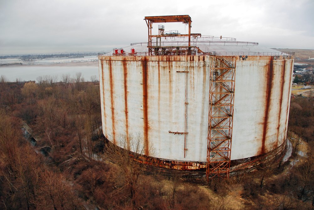
One of the liquid natural gas tanks, at the edge of the Rossville Municipal Site, as seen in 2012. The tanks are each 120 feet tall and 270 feet in diameter. The structures have been empty and unused since their completion in 1974.
24_Kensinger_Rossville_2012_DSC_2649.jpg
One of the liquid natural gas tanks, at the edge of the Rossville Municipal Site, as seen in 2012. The tanks are each 120 feet tall and 270 feet in diameter. The structures have been empty and unused since their completion in 1974.
Nathan Kensinger for Gothamist