Coastal barriers finally begin to rise around NYC — but can they stop the next Hurricane Sandy?
Oct. 29, 2022, 10:01 a.m.
For the communities that will be shielded by these new coastal defenses, they offer an extension on life. Yet for some residents, these walls and levees are not a welcome addition.
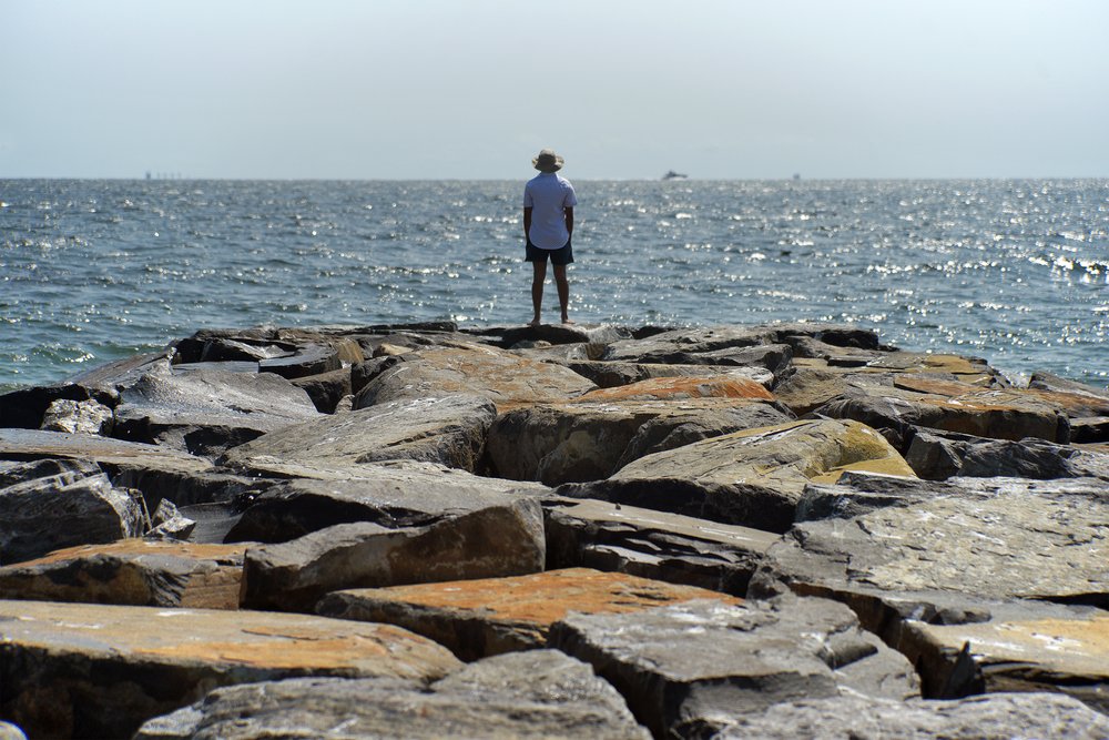
A newly completed jetty on the Rockaway Peninsula in Queens. Photo taken Sept. 17, 2022.
If Hurricane Sandy were to occur again today, many of the same coastal neighborhoods it destroyed would be inundated again. But a slate of climate infrastructure projects initiated in the aftermath of the storm are now — finally — making progress along the city’s waterfront.
Billions of dollars of seawalls, jetties, breakwaters, and reinforced dunes are being erected along the waterfronts of Staten Island, Manhattan, and the Rockaway Peninsula. These barriers promise to protect the coastline for several decades ahead, as sea levels rapidly rise and severe storms become more frequent. The entire 520-mile coastline of New York City faces an uncertain future amid these threats.
Significant work has been completed on three of these ongoing projects, which will cost $1.9 billion in total: the East Side Coastal Resiliency project in Manhattan, the Living Breakwaters in Staten Island, and the Rockaways-Atlantic Shorefront project in Queens. Preparatory work has also begun for a seawall that will stretch along Staten Island’s east coast, and construction is expected to begin in the next few weeks on a coastal barrier in Battery Park City, as part of the South Battery Park City Resiliency project.
In total, more than $4 billion of coastal barrier systems are currently being built in New York City, or are expected to break ground in the next two years.
For the communities that will be shielded by these new coastal defenses, they offer an extension on life. Yet for some residents, these walls and levees are not a welcome addition, or the best answer to sea level rise and climate change.
Protestors have decried the environmental and social impacts of these enormous construction projects. During the first stage of demolition of East River Park for the East Side Coastal Resiliency project, hundreds of mature trees and thousands of plants were destroyed, and more than 100 more trees are scheduled to be chain sawed as part of the impending demolition of Wagner Park in Battery Park City for the South Battery Park City Resiliency project. Critics have also questioned how long these projects will be effective, with New York City facing up to 9.5 feet of sea level rise by the end of this century.
Many of these projects have a design life of just 50 years — and will address just a few feet of rising seawater.
Ultimately, walls along the coastline work in some places, and not in others. And they come with their own set of tragedies and tradeoffs.
Kizzy Charles-Guzman, executive director, NYC Mayor's Office of Climate and Environmental Justice
“Ultimately, walls along the coastline work in some places, and not in others. And they come with their own set of tragedies and tradeoffs… So none of these are perfect solutions,” said Kizzy Charles-Guzman, the executive director of the NYC Mayor's Office of Climate and Environmental Justice. “There is no silver bullet. None of these one things is going to keep us 100% safe. Nobody can live behind a wall and pretend that a severe rainstorm is not going to touch them.”
In the aftermath of Hurricane Sandy, New York City has implemented a multilayered, multiple-hazard approach to climate change that does not depend solely on coastal defenses, according to Charles-Guzman. This includes zoning changes, legislation, and green infrastructure projects initiated under the previous administration of Mayor Bill de Blasio.
“Of course these projects are fantastic and will take us a long way towards protection. And we need more,” Charles-Guzman added, citing the need for a more equitable distribution of projects citywide to address the grim prognosis of how climate change will impact New York.
“We know it's a climate crisis,” said Charles-Guzman. “We are preparing for an unprecedented future, for sure. And we are going down swinging.”
Staten Island breakwaters and seawalls
On Staten Island, Hurricane Sandy damaged thousands of homes along the coast and claimed 24 lives, more than any other borough. Communities here have taken radically different paths towards recovery, ranging from elevating neighborhoods up above the flood line, to the city’s first official managed retreat away from the waterfront. Several of these initiatives were managed by the Governor's Office of Storm Recovery, or GOSR, an agency created in Sandy’s wake by then-Gov. Andrew Cuomo.
“Staten Island experienced half the deaths during superstorm Sandy, and certainly we want to do everything we can to make sure our communities there are safe in the future,” said Katherine Brennan, the current executive director of GOSR. “In terms of what it really means 10 years out, the governor recognizes that it's not if, but when we get more storms.”
In January, current Gov. Kathy Hochul announced that GOSR would become a permanent part of the state government — and rebranded as the New York State Disaster Recovery and Resiliency Unit.
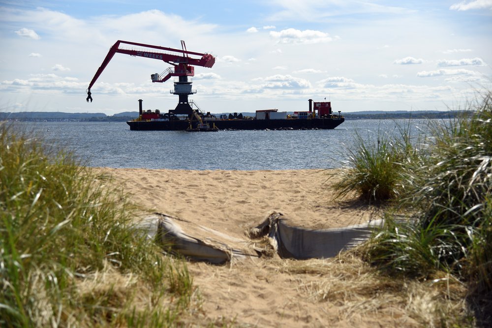
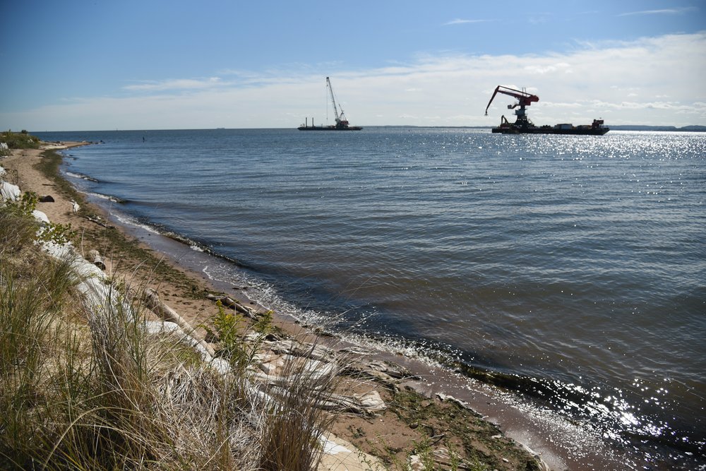
The agency is currently building the Living Breakwaters, the only long-term coastal defense project that has broken ground on Staten Island since Hurricane Sandy. This $107 million project is installing eight enormous stone barriers off the coast of Tottenville, at the southernmost end of the island, which will protect against storm surges, coastal flooding, and erosion.
After beginning construction in late 2021, the first two breakwaters are now visible above the waterline and expected to be completed this fall. Three others are midway through construction. Seals and shorebirds have quickly moved onto these rocky berms, which poke out just a few feet above the sea.
“Even if the water gets higher, they will still knock down waves. Even if the water is above them, until it's many many feet above them, they will function,” said Pippa Brashear, the project manager and a planning principal at SCAPE, which designed the breakwaters.
When complete, the Living Breakwaters are designed to protect a mile of coastline from up to 18 inches (1.5 feet) of sea level rise, which may occur as soon as the 2050s, according to projections from the New York City Panel on Climate Change. The breakwaters are designed for a functional lifespan of 50 years, after which they will slowly become less effective against tidal flooding and storms.
“They are durable, they are going to be there, and even if something degrades, they still function,” Brashear added. “It's not like a wall, that if you don’t maintain it to a T all the time, it's just going to stop functioning.”
The next major coastal barrier on Staten Island will land to the north of Tottenville. The U.S. Army Corps of Engineers will soon break ground on an enormous wall along the island’s east coast, as part of the South Shore of Staten Island Coastal Storm Risk Management Project. It is now expected to begin construction in early 2023. As part of the project, the Army Corps is finishing the final design for a 5.3 mile long barrier along the oceanfront and has mowed and sprayed 136 acres of invasive phragmites, in preparation for building the first of the project’s sprawling inland drainage systems.
In a 2016 feasibility report, the Army Corps estimated the South Shore of Staten Island Coastal Storm Risk Management Project would cost $615 million, but officials said the price could now change as they finalize their plans. The seawall was initially designed to protect the coast from a storm surge 2 feet higher than Hurricane Sandy — and for just 1.1 feet of sea level rise over the next 50 years, a rate at the lowest end of the city’s climate projections.
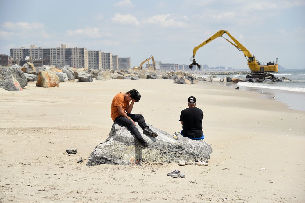
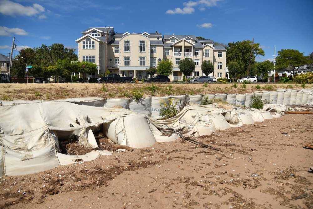
For Staten Island residents, who have lived through decades of storms and floods, these coastal barriers are no guarantee of safety. On a recent autumn morning, Maureen Gannon was sunning herself atop a temporary berm that currently protects the coast of Tottenville. Her beach chair was perched on a long row of sandbags that were deposited here in the aftermath of Hurricane Sandy. Many of these bags have since burst open, spilling their contents back into the Atlantic Ocean.
This eroded barrier looks out onto a panoramic view of the Living Breakwaters site, just a few hundred yards offshore.
“It’s a nice place to sit on a sunny day. I try to ignore all the construction,” said Gannon, a lifelong Staten Island resident who was living in Tottenville during Hurricane Sandy.
“It’s amazing that this benign body of water did that much damage. I couldn’t get home for two days,” she recalled. “People lost their lives right up the street.”
In Gannon’s estimation, the barriers being built along the coastline will not be enough to protect against future storms and floods.
“Nature is going to do what nature wants, ” she said. "Millions of dollars spent on this, and after a matter of years, or a bad nor’easter, it’s all gone.”
Rockaways coastal barriers
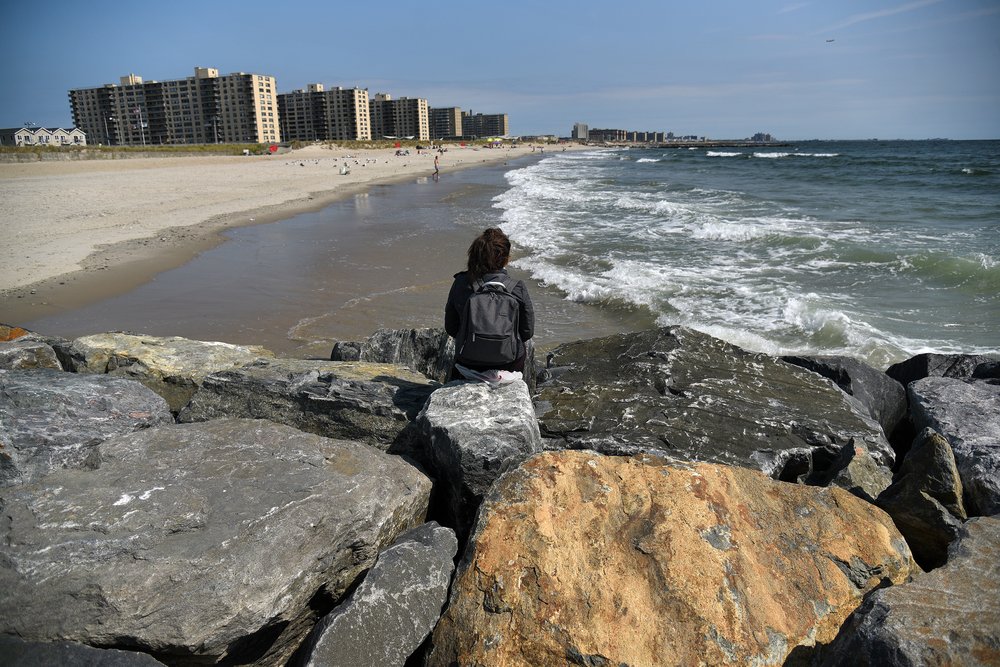
On the Rockaway Peninsula, which was inundated during Sandy, the recovery process has included building new coastal barriers along the entire oceanfront. The coastline has been completely reshaped by these multiyear construction projects, which have also limited access to the beach during summer months.
The city completed a $341 million reconstruction of the Rockaway Boardwalk in 2017, replacing a wooden structure that was badly damaged during the storm with a reinforced concrete barrier. The new 5.5 mile long boardwalk was designed to resist the impacts of storm surges and sea level rise, and is lined by protective walls and sand dunes.
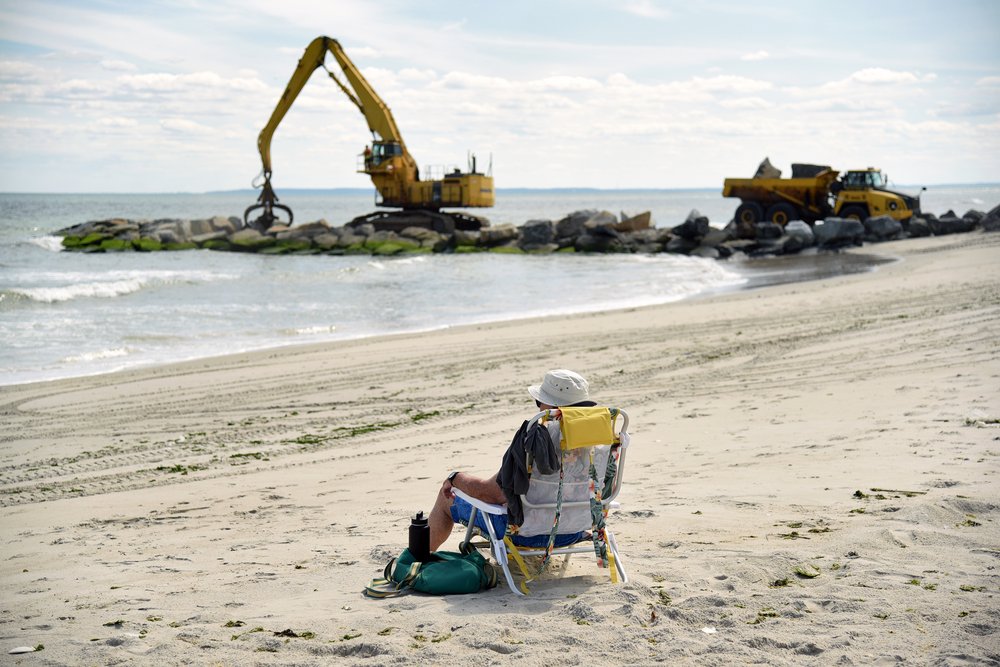
By 2020, the Army Corps of Engineers had broken ground on a $340 million system of jetties and reinforced dunes along this same stretch of coastline. These barriers are part of the Rockaways-Atlantic Shorefront project, which aims to build or rehabilitate 19 enormous rock jetties extending out into the ocean. It is also pumping in 2.5 million cubic yards of new sand to replace eroded beachfront and remake the dunes.
Ten new jetties have already been completed, according to a statement from the Army Corps, along with the rehabilitation of two older structures, and the agency has begun replenishing the beach in Far Rockaway. The jetties are expected to be completed by autumn 2023, while the reinforced dunes will be completed in 2026.
From atop one of these massive new jetties, as waves crash over the rocks, the coastline of the Rockaway Peninsula still looks vulnerable.
In the end, the jetties and all this stuff probably buys us a little extra time in the Rockaways. Maybe a couple decades.
Sam Fleischner, filmmaker
“What they are doing is so substantial and massive. Huge machines, moving these 10-ton rocks around,” said Sam Fleischner, a filmmaker who has been documenting the Army Corps' work for a year. “Then you turn and look out, and the horizon really dwarfs that, and the ocean dwarfs that.”
For Fleischner, whose home in Rockaway Beach was flooded with 7 feet of seawater during Sandy, the new boardwalk and jetties offer a limited measure of protection.
“In the end, the jetties and all this stuff probably buys us a little extra time in the Rockaways. Maybe a couple decades,” said Fleischner. “The damage will probably be a lot less than it was 10 years ago during Sandy, but when you really look at the amount of energy that goes into putting these things in place, it's hard to feel like that's the right way to go. Trying to out-engineer nature is always a losing battle.”
Lower Manhattan resiliency
The largest systems of coastal barriers currently planned for New York City are located in Lower Manhattan, where Hurricane Sandy’s floodwaters surged through the streets of several neighborhoods, including the Seaport District, Battery Park City, and the Lower East Side. Several interrelated coastal resiliency projects are being designed here, under the umbrella of the Lower Manhattan Coastal Resiliency Project.
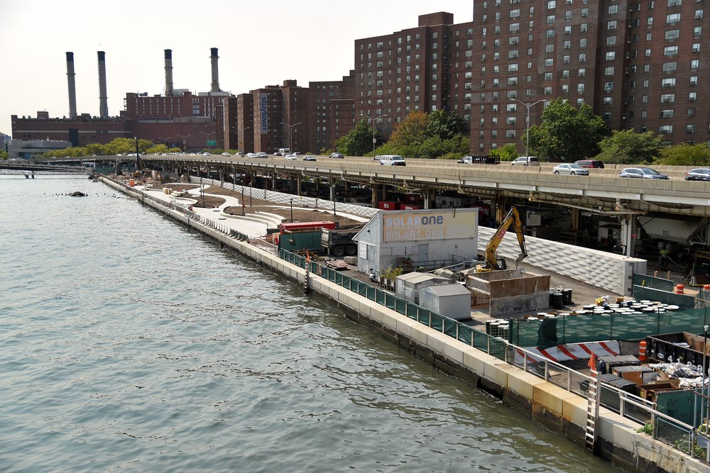
But the project that has made the most progress is the controversial $1.45 billion East Side Coastal Resiliency Project. The NYC Department of Design and Construction began work on the project in 2020. It will eventually result in a 2.4 mile long coastal protection system consisting of 18 storm surge gates linked to seawalls along the East River waterfront.
The first two storm surge gates were completed in 2022 – a 45-ton gate in Asser Levy Playground and a 16-ton gate in Stuyvesant Cove Park. Overall, 1,100 feet of seawalls have now been built in the park, with pilings extending more than 100 feet below ground. The upper portion of this wall is visible as a rippling concrete barrier, which stands next to a newly built promenade along the East River.
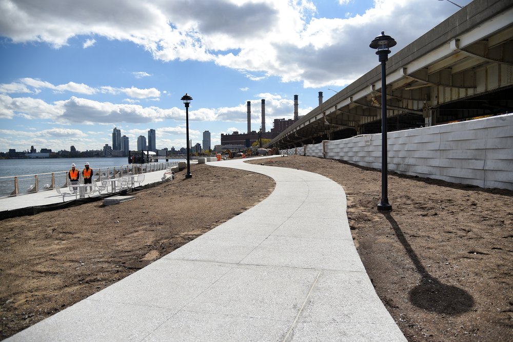
The park’s previous landscape was completely demolished to build this barrier, and a new collection of trees and plants will be installed here in the next two weeks. The majority of Stuyvesant Cove Park is expected to reopen by Thanksgiving, according to Thomas Foley, the commissioner of the Department of Design and Construction.
Further down the coast, the southern half of East River Park has now been almost completely razed as part of the East Side Coastal Resiliency Project, including the recent demolition of the historic 1938 Tennis House. In September, workers in hazmat suits cleared out a cache of asbestos found underneath the park’s demolished amphitheater, and are now removing the waterfront esplanade and pumping gravel 50 feet underground to stabilize the site. The next phase of work will build a seawall across the middle of the park’s footprint, which will then be completely buried underneath an 8-foot-high mound of dirt.
All of the different sections of the East Side Coastal Resiliency Project project must be completed before it can work as a flood control barrier, and construction is expected to last until 2026.
“When things do inevitably hit the fan, they will afford the protection that’s needed,” said Foley, during a recent site visit to Stuyvesant Cove Park. “It’s not only the largest resiliency project in New York City, but actually in the Western Hemisphere.”
Designing and implementing the East Side Coastal Resiliency Project has been a bruising battle. Protesters from the neighborhood, including the East River Park Action coalition, have described the city’s plans to demolish East River Park and chainsaw 991 trees as an environmental disaster. They filed several lawsuits in an attempt to halt the project. Despite numerous rallies, marches, and protests, the city rushed to begin demolition at the park during the final weeks of the de Blasio administration in December 2021, ignoring a temporary restraining order.
The East Side Coastal Resiliency Project is intended to protect the Lower East Side, East Village, Stuyvesant Town, and Peter Cooper Village from a 100-year flood event and 30 inches (2.5 feet) of sea level rise, which could occur as soon as 2050, according to the city’s climate projections. The barrier has been engineered for 100 years of useful life, but can accommodate being raised by two extra feet. That would mean demolishing the new landscapes, to place an additional layer of fill on top.
“I don’t think that a project on the scale of ESCR [East Side Coastal Resiliency Project] can really be seen as a short-term solution. My God, right? It's taken us 10 years to truly get the coordination and the management and the contracting, and just the implementation of that project is long term,” said Charles-Guzman. “We do know that with sea level rise, many places in New York City will look very different in 2100. And so, are these projects being built to the highest level of protection that we possibly can do? And I don’t know that.”

Lower Manhattan’s next coastal barrier is the South Battery Park City Resiliency Project, which is part of the larger Lower Manhattan Coastal Resiliency Project. In the next few weeks, the Battery Park City Authority plans to close down Robert F. Wagner Park and begin its demolition, as part of a $221 million plan, despite ongoing protests by community members.
The park will be replaced by 10 feet of fill, as part of a system of floodwalls and flood gates that will extend from the Museum of Jewish Heritage down to the northern edge of the Battery. The barriers planned for Battery Park City are projected to last at least 50 years — but may need to be updated before then, depending on the rapidity of sea level rise and the impacts of climate change.
“We have to be able to adapt as we go along, because there is a lot that we still don’t know, about exactly when things are going to happen and how bad it might get, and how quickly it might happen,” said Gwen Dawson, the vice president in charge of resiliency projects at the Battery Park City Authority. “If we need to, in another 15 or 20 years, bolster this or add some additional height to some of these measures, we are able to.”
The next barrier systems that will break ground in Manhattan include several more components of the Lower Manhattan Coastal Resiliency Project. The $522 million Brooklyn Bridge-Montgomery Coastal Resilience project was due to start construction this fall, the $165 million Battery Coastal Resilience Project is expected to begin construction in 2023, and the $631 million North/West Battery Park City Resiliency Project is anticipated to begin work in 2024.
Harbor and Tributaries Focus Area Feasibility Study
Even as these enormous projects break ground, new plans are being made for larger coastal barriers. In September, Gothamist broke the news that the Army Corps had released a new report detailing its proposed plan for the NY & NJ Harbor & Tributaries Focus Area Feasibility Study, or HATS.
This plan calls for 12 massive storm surge gates to be built across waterways throughout the New York City metropolitan region, along with more than 41 miles of levees, seawalls, and other coastal barriers along the city’s shoreline.
“We think of the HATS study as a critical step in the next generation of coastal resiliency projects for the New York and New Jersey Harbor. It is too big a deal for us to not care about it,” said Charles-Guzman.
If approved, funded and built, this $52 billion project would be, by far, New York’s largest system of coastal barriers built to address climate change, and would reshape the city’s waterfront. However, it is not estimated to be complete until at least 2044, decades after the current crop of coastal resiliency projects.
The HATS plan would have a design life of 50 years, so would only provide protection against storm surges until the end of this century.
“What I want to say about HATS is that it is critically important, and it might not be enough,” said Charles-Guzman.