Here's The Original Manuscript For NYC's Street Grid Plan
Sept. 1, 2021, 8:59 a.m.
The Commissioners' Plan of 1811 is often named one of the most important documents in New York City's development, the map is often considered far-reaching and visionary for its time.
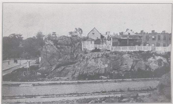
Early Manhattan grew organically as inhabitants settled the southern tip of an island replete with hills, cliffs, streams, and wetlands. Individuals built streets around private land boundaries and natural barriers such as creeks, creating a tangle of roads familiar to anyone who has explored neighborhoods like Greenwich Village. But as the city’s population grew exponentially, tripling between 1790 and 1810, the state legislature appointed three commissioners to establish a plan that would prepare for and regulate the city’s anticipated growth northward. In turn, the most important map of New York published after the American Revolution was created.
The Commissioners' Plan of 1811 was the original design for the streets of Manhattan above Houston Street, which utilized the rectangular grid plan of streets that created the base for the modern plan of Manhattan. Often named one of the most important documents in New York City's development, the map is often considered far-reaching and visionary for its time.
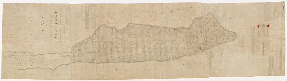
The plan originated when the Common Council of New York City, seeking to provide for the orderly development and sale of the land of Manhattan between 14th Street and Washington Heights, but unable to do so itself for reasons of local politics and objections from property owners, asked the New York State Legislature to step in. The legislature appointed a commission with sweeping powers in 1807, and their plan was presented in 1811. The Commissioners were Gouverneur Morris, a Founding Father of the United States, John Rutherfurd, a former United States Senator; and the state Surveyor General, Simeon De Witt. Their chief surveyor was John Randel Jr., who was just 20 years old when he began the job.
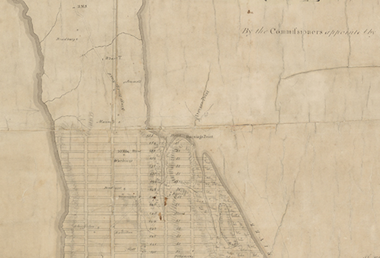
The Library holds one of three original manuscript versions of the 1811 plan, which lays out a grid that would replace existing roads and farms, also visible on the map, and extend up to 155th Street—an expansion that would take 60 years and significantly reshape the geography of the island. Notably absent: Central Park, which was not yet envisioned as a part of Manhattan. Also note that the streets were numbered all the way up through the Bronx.
One of the manuscript versions of the map that shaped the city will be among the 250 items on display as part of the permanent Polonsky Exhibition of The New York Public Library’s Treasures. To explore other historic maps from the Library’s collections, visit the Digital Collections.
This story is part of our partnership with the NYPL around the exhibition, which showcases items spanning 4,000 years from the Library's research collections. The objects and the stories behind them are meant to inspire, spark curiosity, and encourage deeper thinking about our history and world—we'll be publishing one NYC-related object a day throughout September, and you can see everything at gothamist.com/treasures.
The Treasures exhibition opens Friday, September 24th, 2021 at the Stephen A. Schwarzman Building on Fifth Avenue and 42nd Street. Free timed tickets are now available here.